
Ballysadare River
| Grade: | 3 to 5 | Rating: |  |
|||
| County: | Sligo | Date updated: | 29/06/2010 | |||
| Section Length: | 0.5 km | Version: | 5 (History) | |||
Brief River Description
It's a good park and run, you can just do the falls if you want, or get on at the bridge to do a nice sustained rapid. It doesn't take to much rain to run, but best in flood. Colooney falls is 10mins drive up river.
Directions to the Put-in
The rapids start at the bridge in Ballysadare town and continues it meets the sea about 2km later. Ballysadare town is sign posted on the main Donegal road. If you're just doing the falls, parking is best beside the graveyard on the left river bank. To get around here take the second right after the bridge down a short cul de sac.
Directions to the Take-out
The river take out is left after the falls, just beyond dam tower. Follow path back up.
On the take out River Right after the falls brings you up through private property, please do not use this bank. River left below the high drop will bring you back up along a path into Ballisadare village.
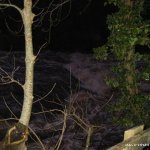
River Description
The Ballysodare rapids vary with level and all can be seen from road. One thing to look out for is two small waves above the main drop on the stepped side. In flood, they have the power to flip a boat, but more likely just mess your line up.
The main drop has two sides. The left has a straight drop thats 5m-7m (20ftish) high depending on tide and is shallow on low tide. The right is the more exciting line with a stepped drop that looks great in high water. The stopper at the bottom just flushed us out but I don't know if thats always the case and I've heard of shopping trolleys being visible in low water. The river flows into a tidal lagoon so tides can have an affect on the hydrolics at the base of the main falls.
A sizeable hydrolic can form at the base of the falls in high water.But generally the speed you generate running the drop 'usually' carries people through without incident. The bottom of the river right line has a cave river right, against the wall. I've never encountered any problems with the cave (and it's trolls!), but apparently it is something to be aware of.
Local issues
The river right bank is private fisheries land and they don't like kayakers, but they seem o.k. with us using the left bank.
River level gauge
The river itself is predominately flat for most of its course, so it retains its water well after rain. If it looks good to go it is.
River Hazards
Low tide twattings off the river left side, and possibly the wee cave river right on the final drop.
The sally gardens drop (the 1st hole) has a Bar or two still in place from where the local fishermen have blasted it, this bar is on river right and will be below the water line on a day with good water, it is pointing down stream which is a help but it cannot be moved, it has been tried.
Author(s)
Original Author: BoscoLatest Author: Seanie
(Full History)
Please add river details by adding to/editing the guide.